
3DLS reality capture & high definition survey
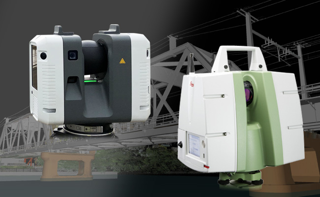
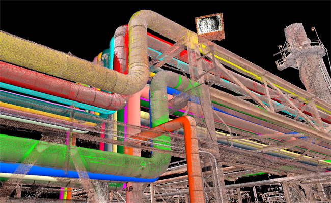
3D laser measurement is the technology that will usher in the coming 3D information age.
The "point cloud" of data acquired with a 3D laser scanner improves all kinds of operations.
We offer low-cost, high-performance measurements that are tailored to the site environment and purpose of use.
Measurement itself is important for the accuracy of 3D data.
Also, planned and prepared measurement is important for data processing.
It is important to go back to the starting point.
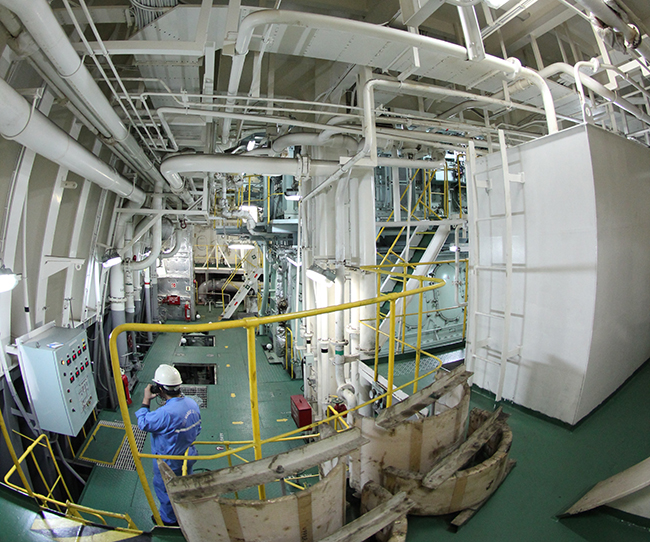
BWTS/Retrofit design
The point cloud acquired by 3DLS measurement is used in the design of onboard ballast water treatment equipment, where 3D design is the mainstream.
 With a measurement track record of over 30 vessels, we are able to provide measurements that reliably meet the needs of our customers.

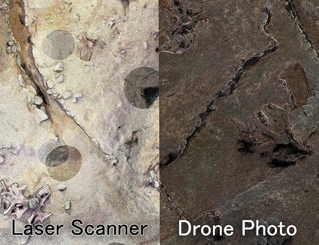
Historic ruins
For the preservation of historical buildings, 3D measurement is being used to save the current state as it is as digital data.
Proposals can be combined with UAV aerial photography.
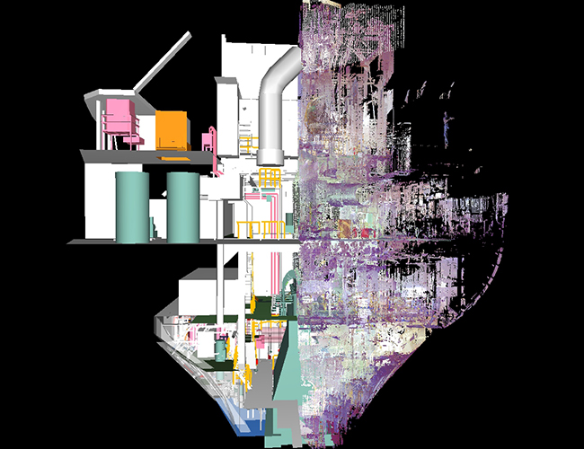
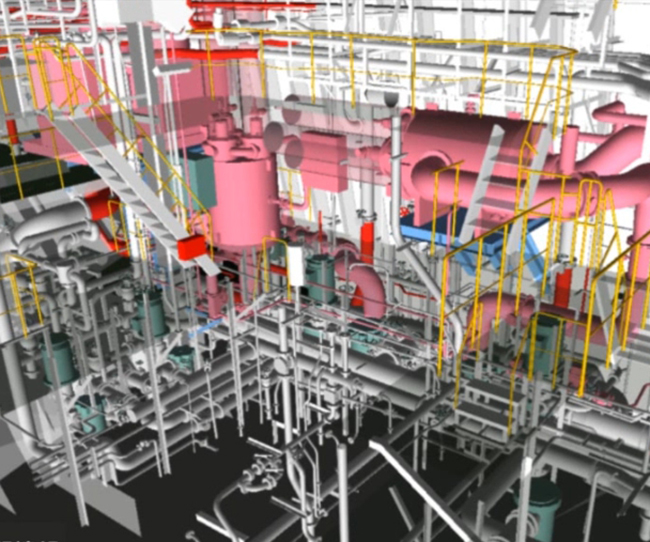
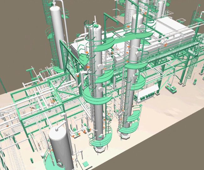
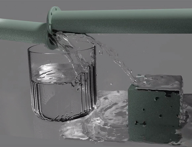
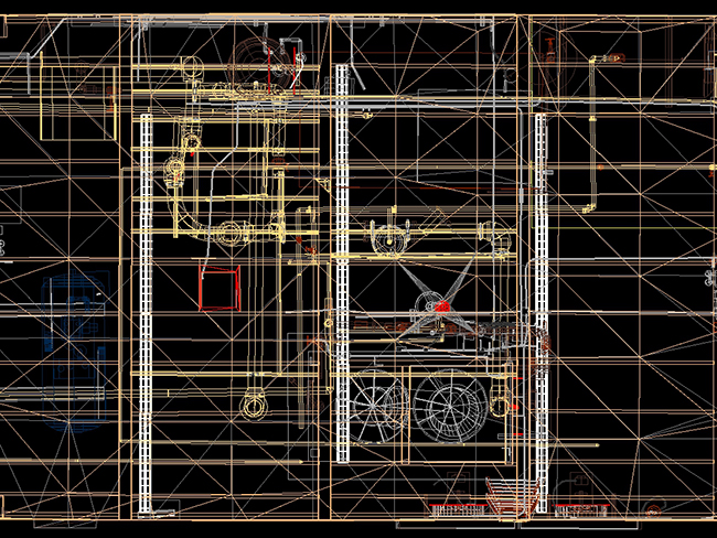
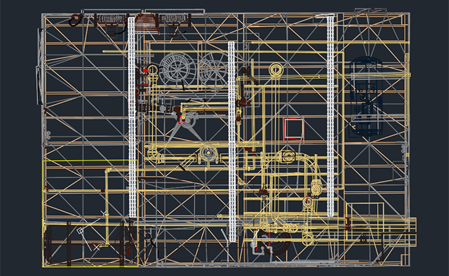
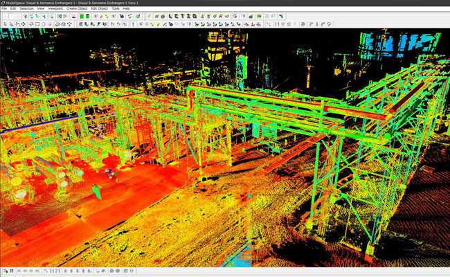
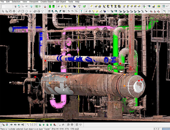
Plant
There are no 2D drawings / the current status due to modification is not known.
In such cases, drawing with 3D measurement data is effective.
Modeling and drawing by 3D measurement makes repair work much more cost-effective.
BWTSモデリングまでの流れ

【3DLS計測】
3DLS計測の説明
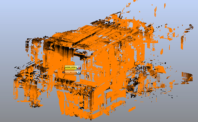
【合成】
ここに合成の説明
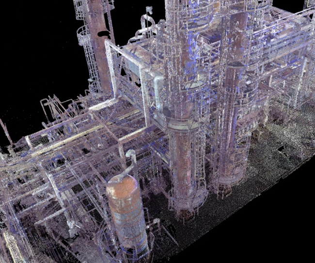
【点群】
ここにできあがった点群の説明
【モデリング】
ここにモデリング方法などの説明
【モデリング完成】
ここに完成モデリングの形式などの説明
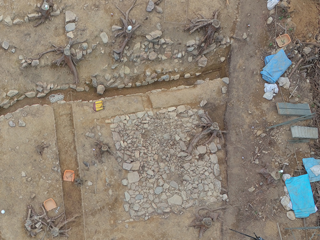
![]() 遺跡の3DLS計測
遺跡の3DLS計測
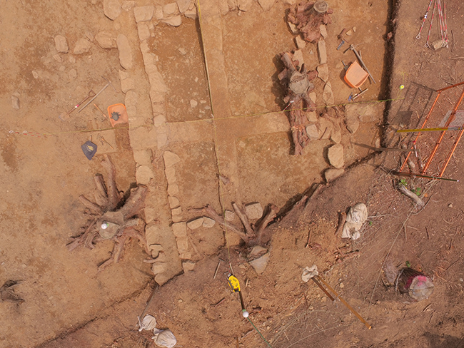
【現場の写真】
ドローンを使った空撮であるとかそういった説明
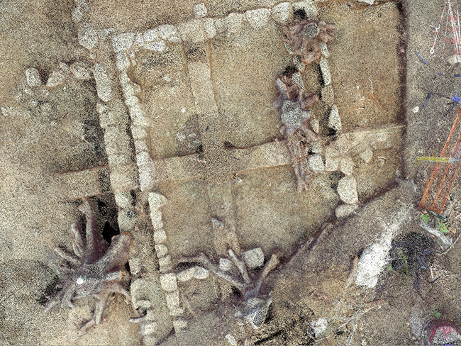
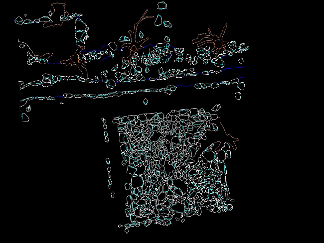
【計測による点群】
左の写真に近い点群の写真や説明

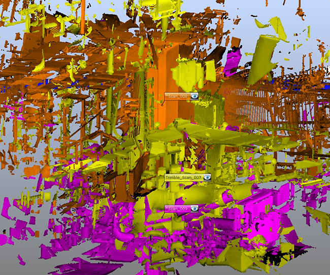
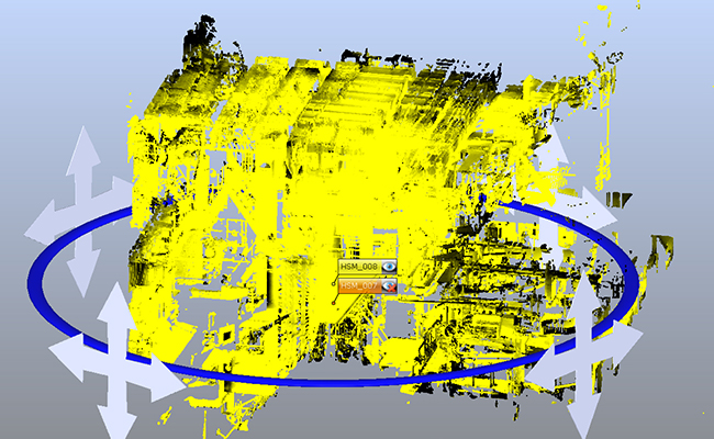
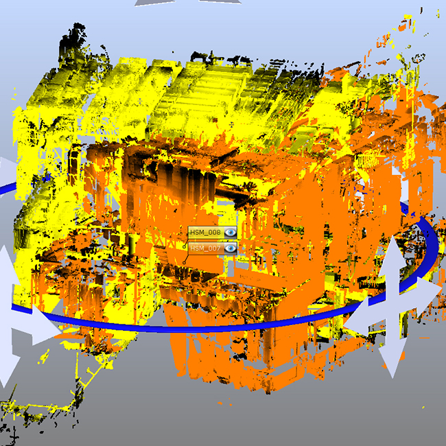
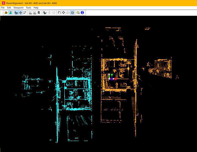
Point cloud registration/Alignment
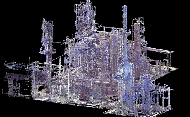
This is the process of combining point cloud data acquired at multiple locations into a single file.
As with measurement errors, errors called synthesis errors accumulate in the synthesis process.
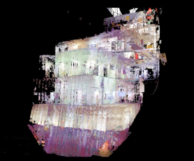
We provide high quality point cloud data by synthesizing the data considering the accuracy of the final product.
Please consult with us about measurement data that cannot be synthesized by FARO SCENE, Infipoints, etc. We cannot guarantee 100% accuracy, but we can provide high-quality point cloud data.
We cannot guarantee 100% accuracy, but we will synthesize the data.
Please prepare not only the composite point cloud data but also the raw measurement data.
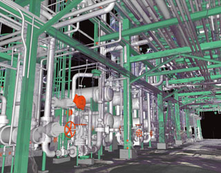
As-built modeling/3DCAD
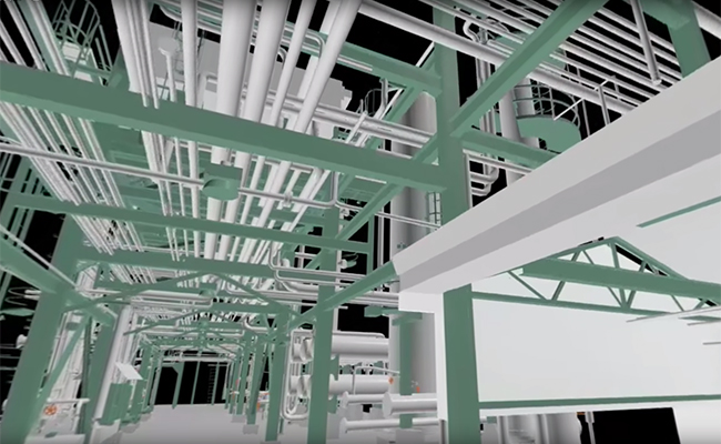
3D CAD is created based on point cloud data that perfectly reproduces the site through measurement/composition.
Accurate models based on JIS standards can be used for a variety of secondary purposes, including 2D drawing creation and interference checking.
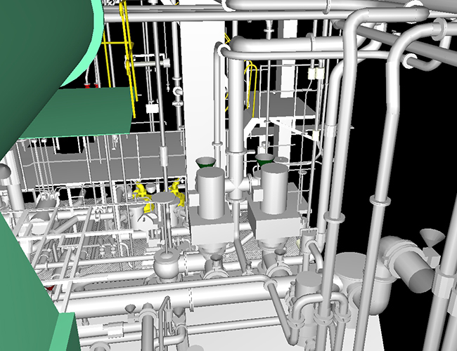
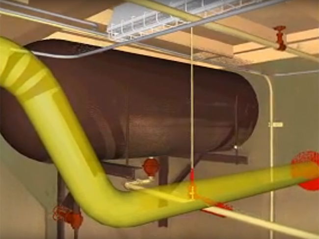
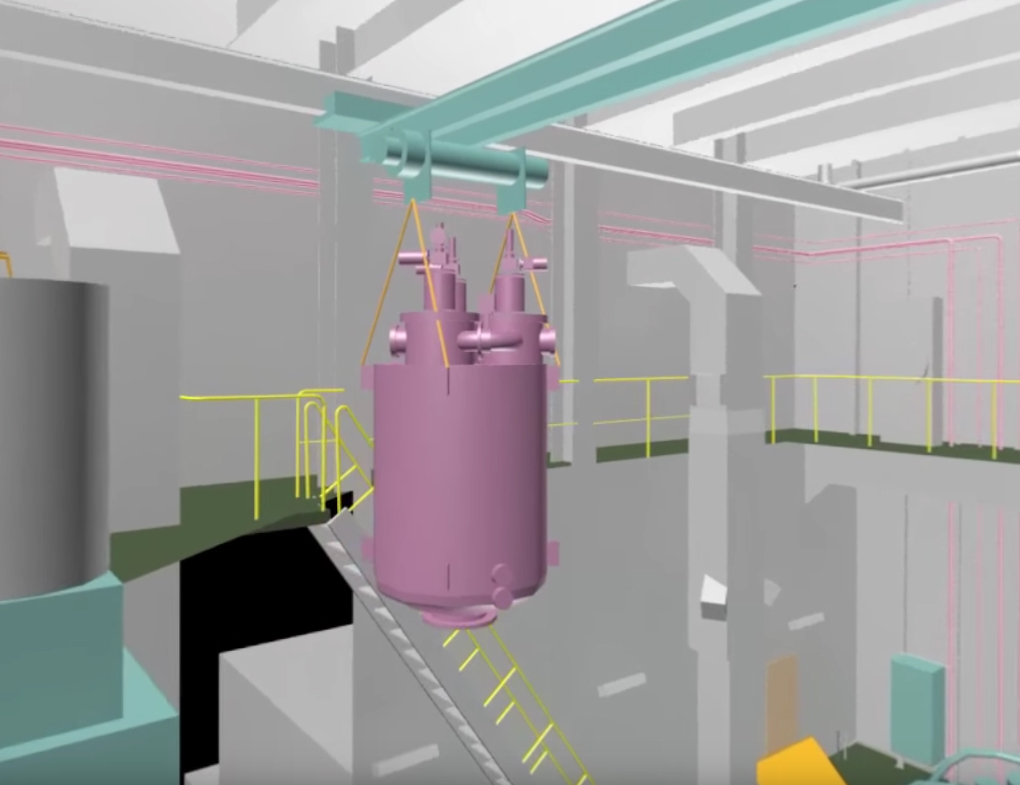
BWTS/Retrofit design
3DCAD created based on the measured point cloud can be used for basic/detailed design and interference verification.
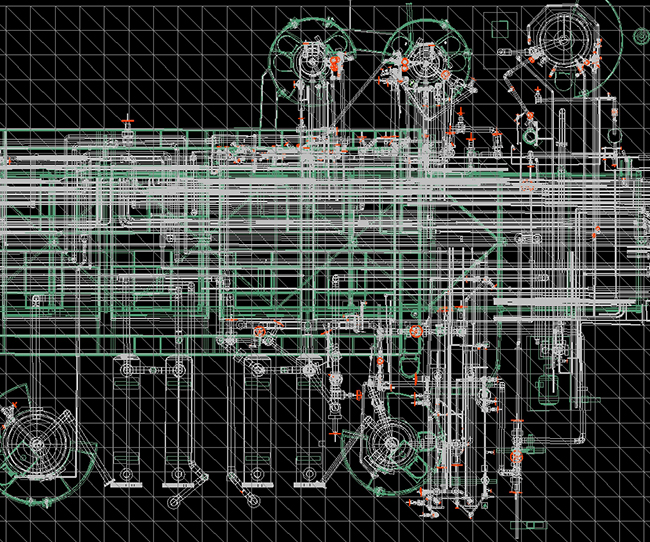
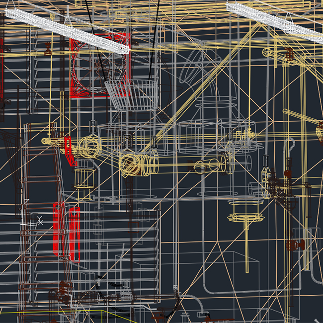
3D isometric view
Utilizing 3DCAD data, interference checks can be visualized.
Application of 3D models
By creating a 3D model, you can use it to create videos and presentations for interference verification.
Create validation videos based on accurate model data from 3D measurements.
Sample data
We provide sample 3D CAD data modeled by our company free of charge. Please use it to check compatibility with your software.
Please contact us to inquire about any problems or to check specifications.


DX "Digital Transformation" Conservation
Various data can be integrated with 3D data.
Integrate drawings with 3D data as well.
Build useful digital data at the minimum necessary cost and realize DX.
Simply digitizing is meaningless.
The outcome of digitization is to be beneficial.
We will help you based on our past experience.
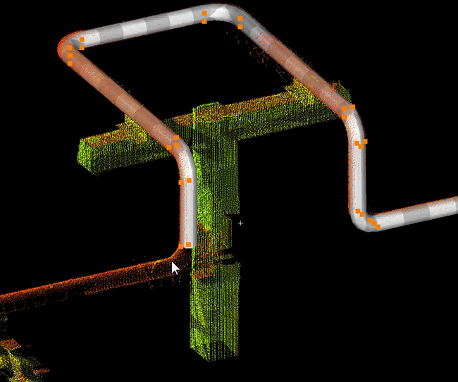
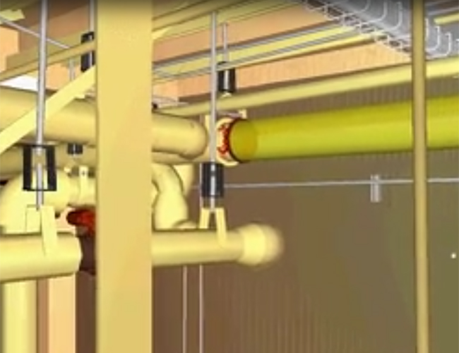
3D isometric view
Piping survey is performed using a 3D laser scanner to survey the existing conditions.
Check against existing drawings and documents for From-To, numbers, and P&IDs.
We create isometric and P&ID drawings of the necessary systems.
We can also create 3D isometric drawings and 3DP&ID drawings upon request.
Why don't you work on it as DX?
By adding attribute information, it is possible to save labor and cost for maintenance.
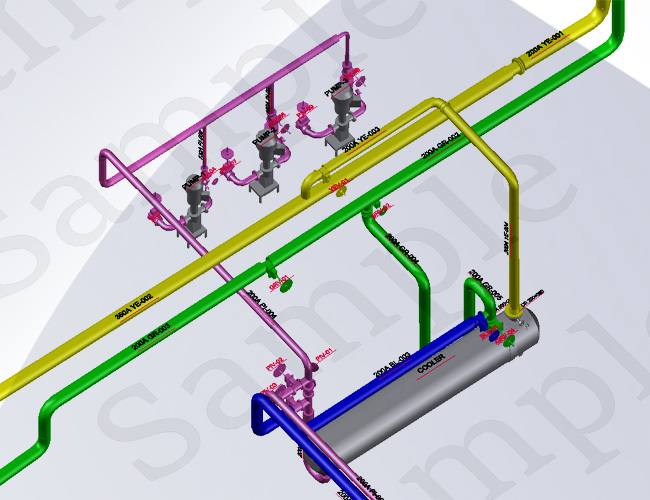
3D isometric view
Isometric drawing in 3D
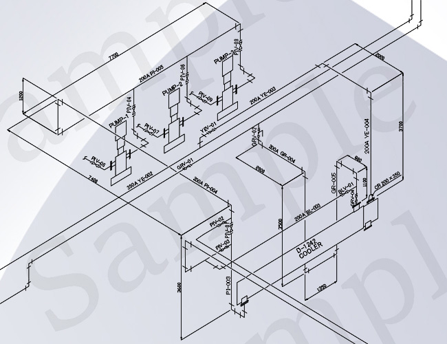
2D isometric drawing
Isometric drawing in 2D
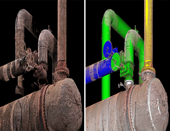
Point cloud to model
It is also possible to make a 3D model that shows the valve type.
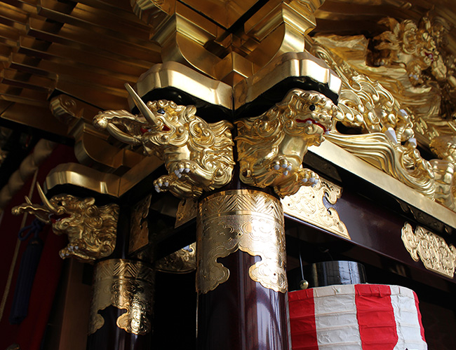
Historical building scan
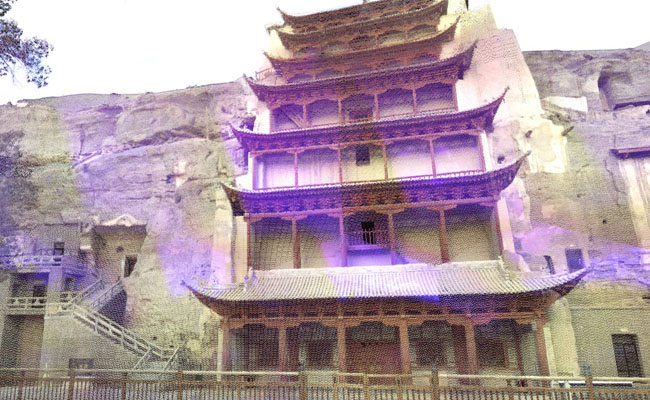
Utilizing point cloud data for surveys to determine the current status of historical buildings and for repair plans will help preserve cultural properties.
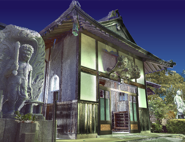
Temple
View temples of point cloud data measured using a 3D laser scanner in VR.
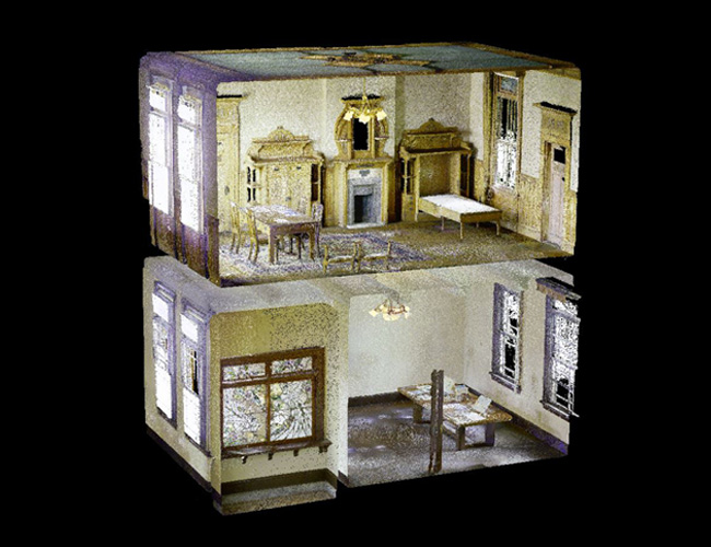
Western-style house
coming soon.
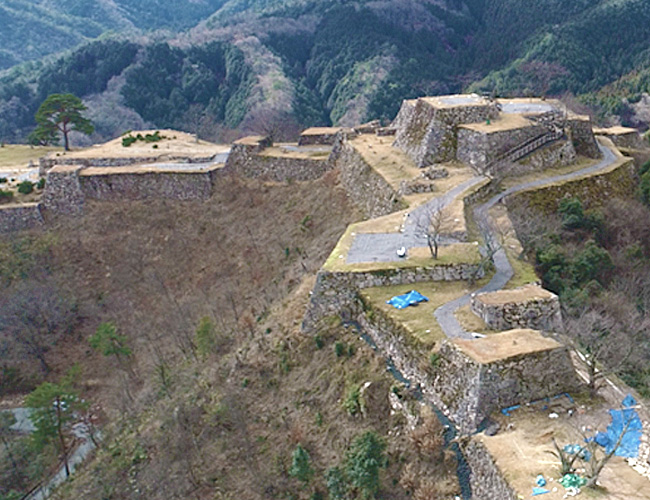
Ruins of Takeda Castle
View the Takeda Castle Ruins (at the time of excavation) in VR with point cloud data measured using a 3D laser scanner.
Cultural Property
Coming Soon

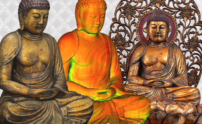
Sitting statue
You can see a 3D model of a sitting image reconstructed by photogrammetry.

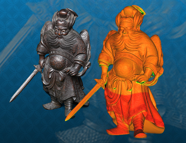
Standing statue
You can see a 3D model of a standing image reconstructed by photogrammetry.
Sculpture
coming soon.
Cyclone software training
The course is based on over 15 years of 3D laser scanner measurement and modeling experience.
The course will cover the operation of Leica Geosystems Cyclone.
The licenses will include Cyclone Register, Cyclone Model, Cyclone Basic, Register360, Field360, and Cyclone Publisher.
Cyclone Register
The measured data is composited from the target, position, location, etc., and can be converted to public or arbitrary coordinates.
Cyclone Model
Accurate modeling is performed based on the synthesized point cloud data.
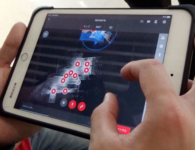
Cyclone Field 360
Data measured with a 3D laser scanner can be pre-processed on the spot from an ipad app and automatically composited.
Panoramic contents
We create panoramic contents along with various 3D data.
We create walk-through videos that make you feel as if you are walking through the 3D data (point cloud/model) and panoramic videos that enhance the appeal of the 3D content.
We also utilize panoramic images obtained from 3D scans and 360° camera images to compile on-site proposals and issues into data that can be shared quickly, contributing greatly to lead-time reduction.
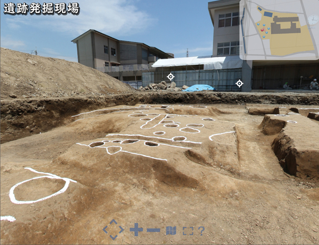
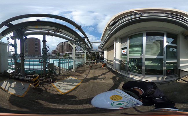
Panoramic VR (historic ruins)
This is an example created based on an outdoor panoramic image.
It is intuitive, easy to operate, and allows the viewer to move 360°.

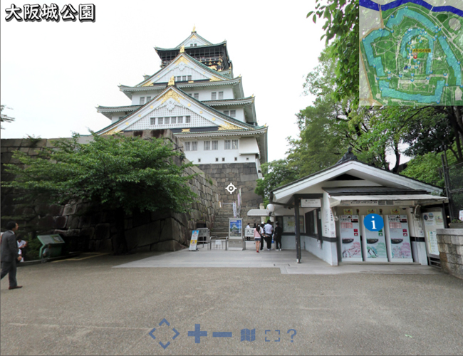
Panoramic VR (Osaka Castle)
By mapping panoramic images to maps and drawings, site information can be quickly shared/confirmed in an offline environment.
No dedicated software is required because a browser is used.
Panorama movie
While a typical video can only be viewed in one direction, a panoramic video can be viewed in all directions.
3D data (point cloud/model) is used to create a walk-through video.
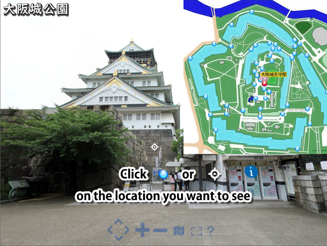
![]() How to operate Panorama VR
How to operate Panorama VR
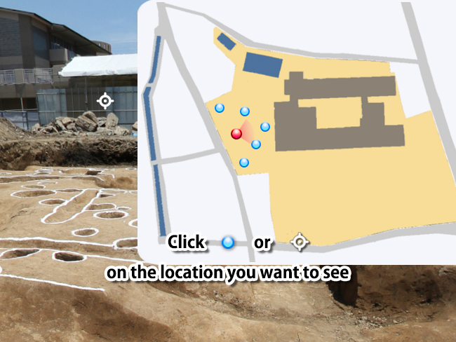
"Click on the location you want to see"
Click on the location you want to see in the map
"Move the mouse around the screen"
Drag the mouse across the screen to move the view in that direction.
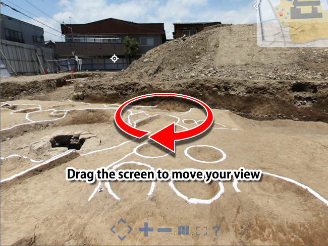
![]() How to operate Panorama VR
How to operate Panorama VR
"Click on the location you want to see"
Click on the location you want to see in the map
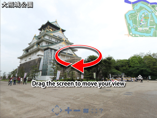
"Move the mouse around the screen"
Drag the mouse across the screen to move the view in that direction.
![]() How to operate Panorama Movie
How to operate Panorama Movie
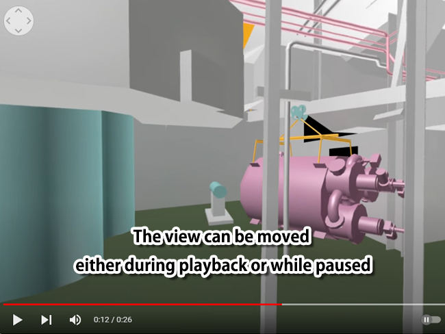
"During video playback"
The view can be moved either during playback or while paused
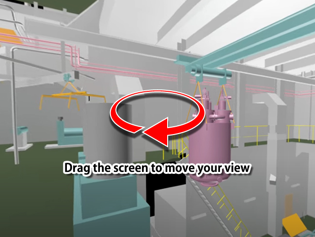
"Move the mouse around the screen"
Drag the mouse across the screen to move the view in that direction.
UAV "Drone"
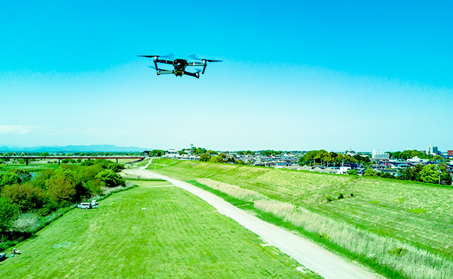
Measurement by aerial photography is possible using UAV "drone".
Since 3D measurements are taken from aerial images, the cost is lower
than 3DLS.
In addition to measurement, we also provide UAV flight training and
practice space.
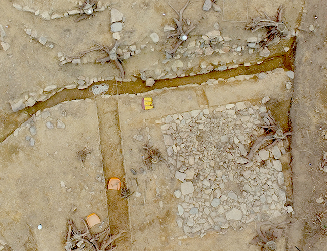
Aerial photography and measurement
The current state of archaeological sites from construction and other activities can be quickly preserved from measurements taken by aerial photography.
We can also process data from aerial measurements into the requested form.
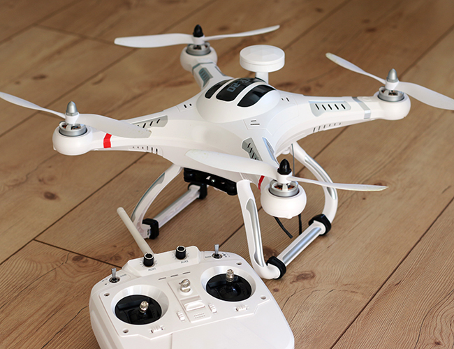
UAV flight training events
Many people have expressed their concern that it is difficult to secure a practice environment for UAV flight.
We regularly hold drone training sessions and events where you can get hands-on experience with drones.
Our staff, who are experienced in UAV flight, will help you practice flying.
![]() 空撮による計測
空撮による計測
【空撮したデータ】
空撮したデータの説明
【ご依頼いただいた形式への加工】
加工できる形式の説明
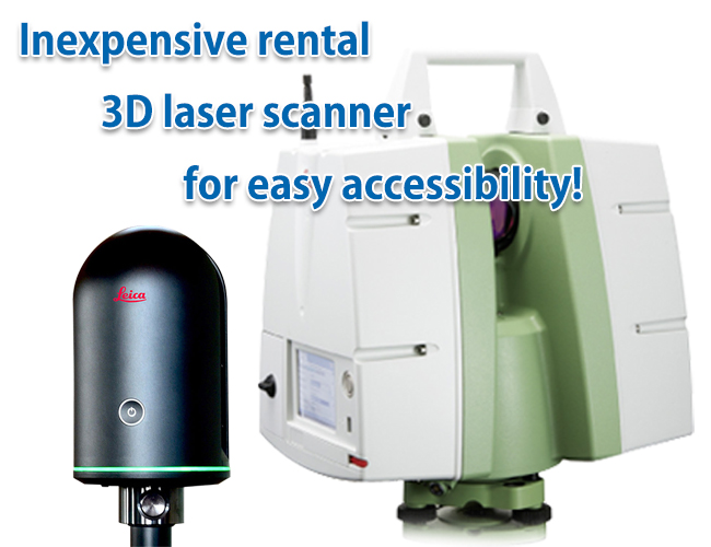
Rental
In recent years, the use of 3D laser scanner measurement has been increasing very much.
However, 3D laser scanners are not inexpensive and are difficult to use if you only want to use them for a short period of time.
We offer a scanner rental service that can be used for as little as one day.
The scanner comes with a full set of accessories and is delivered in a format that allows you to take measurements as soon as you receive it.
We not only provide rental services, but also take care of post-processing after measurement. Please contact us for details.
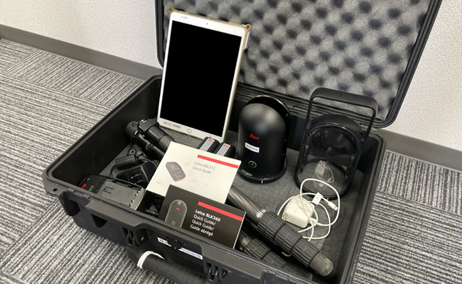
3D scanner rental
The accessories are different from each other. Please check in advance.
If you are not sure which model to rent, please let us know your purpose and site environment. We will recommend a model that meets your needs.
BLK 360 main unit, iPad Pro, 2 Batteries, Charger,
Tripod, Carrying case, Quick guide
Dedicated tripod, Dedicated target and target tripod (6 pairs)
Leveling board, Tape measure, LAN cable, Instruction manual